| Jan 29, 2006 - Torres del Paine National Park, Chile
| (click to enlarge)
 |  | (click to enlarge)
 | | (click to enlarge)
 | | (click to enlarge)
 | All the food, ready to go the night before
| | Driving up to Torres
| | From the bus, those are the towers (torres)
| | Day 1: The start of our walk, through this flower patch
| (click to enlarge)
 | | (click to enlarge)
 | | (click to enlarge)
 | | (click to enlarge)
 | Day 1: Cool wind patterns on a lake
| | Day 2: scenery on the backside
| | Day 2: A waterfall along the way (while I was alone)
| | Day 2: Cloudy mountains in the distance
| (click to enlarge)
 | | (click to enlarge)
 | | (click to enlarge)
 | | (click to enlarge)
 | Day 2: Picking Calafate berries
| | Day 2: Tanner with Calafate tongue
| | Day 2: View from lunch of Lago Dickson
| | Day 2: Me at the lunch spot
| (click to enlarge)
 | | (click to enlarge)
 | | (click to enlarge)
 | | (click to enlarge)
 | Day 2: Lunch
| | Day 2: Looking down at camp Dickson from our lunch spot
| | Day 2: Scenery from Camp Dickson
| | Day 2: A small glimpse at the Dickson(?) glacier
| (click to enlarge)
 | | (click to enlarge)
 | | (click to enlarge)
 | | (click to enlarge)
 | Day 2: Salto Los Perros, waterfalls we passed on the way
| | Day 2: The river beneath Salto Los Perros
| | Day 3: My feet after the mud patch
| | Day 3: Brian after the mud patch
| (click to enlarge)
 | | (click to enlarge)
 | | (click to enlarge)
 | | (click to enlarge)
 | Day 3: Scenery before the pass
| | Day 3: Dan on a bridge
| | Day 3: More of the river we crossed
| | Day 3: A waterfall, from mid-way up the pass
| (click to enlarge)
 | | (click to enlarge)
 | | (click to enlarge)
 | | (click to enlarge)
 | Day 3: Taking a break on the pass, those are people down there on the left
| | Day 3: More from the pass
| | Day 3: Dan and Brian, triumphant at the top (Glacier Grey in the back)
| | Day 3: Tanner on the top
| (click to enlarge)
 | | (click to enlarge)
 | | (click to enlarge)
 | | (click to enlarge)
 | Day 3: Me, last to the top, with Glacier Grey in the back
| | Day 3: Accomplished the pass, time to move on
| | Day 3: Mountains from the top of the pass
| | Day 3: Glacier Grey's edge
| (click to enlarge)
 | | (click to enlarge)
 | | (click to enlarge)
 | | (click to enlarge)
 | Day 3: Looking down at Glacier Grey
| | Day 3: Passing a stream, Glacier Grey, and some Chileans we me the night before
| | Day 3: The bridge crossing that stream, a typically beautiful scene of the Torres trail
| | Day 3: Us crossing that bridge, and the Chileans' packs
| (click to enlarge)
 | | (click to enlarge)
 | | (click to enlarge)
 | | (click to enlarge)
 | Day 3: Still more glacier
| | Day 3: Another section
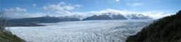
| | Day 3: Panorama 1
| | Day 3: Panorama 2
| (click to enlarge)
 | | (click to enlarge)
 | | (click to enlarge)
 | | (click to enlarge)
 | Day 3: Panorama 3
| | Day 3: Panorama 4
| | Day 3: Completed panorama of Glacier Grey
| | Day 3: Granite peaks, not actually the Torres
| (click to enlarge)
 | | (click to enlarge)
 | | (click to enlarge)
 | | (click to enlarge)
 | Day 3: Brian and Tanner, a fun part of the trail
| | Day 3: Tanner making the climb
| | Day 3: A stream and the peaks
| | Day 3: Dan coming up a ladder
| (click to enlarge)
 | | (click to enlarge)
 | | (click to enlarge)
 | | (click to enlarge)
 | Day 3: Brian and Tanner, picking more Calafate berries
| | Day 3: Tanner picking berries, Lago Grey and Glacier Grey
| | Day 3: Dan, trudging through a chasm
| | Day 3: Lookout point Panorama 1
| (click to enlarge)
 | | (click to enlarge)
 | | (click to enlarge)
 | | (click to enlarge)
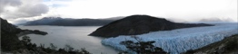 | Day 3: Lookout point Panorama 2
| | Day 3: Lookout point Panorama 3
| | Day 3: Lookout point Panorama 4
| | Completed panorama from lookout point
| (click to enlarge)
 | | (click to enlarge)
 | | (click to enlarge)
 | | (click to enlarge)
 | Day 3: The tip of Glacier Grey
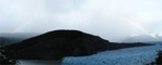
| | Day 4: Panorama of morning rainbow over Glacier Grey
| | Day 4: The second and more impressive rainbow of the day
| | Day 4: Me beneath the rianbow
| (click to enlarge)
 | | (click to enlarge)
 | | (click to enlarge)
 | | (click to enlarge)
 | Day 4: Looking head-on to Glacier Grey
| | Day 4: Wide shot of the glacier's face and surroundings
| | Day 4: Glacier Gery's split face
| | Day 4: From the small pass that day, looking back at Grey
| (click to enlarge)
 | | (click to enlarge)
 | | (click to enlarge)
 | | (click to enlarge)
 | Day 4: Scenery along the way
| | Day 4: Lago Grey
| | Day 4: Some icebergs in Lago Grey
| | Day 4: A smaller lake, Laguna Los Patos
| (click to enlarge)
 | | (click to enlarge)
 | | (click to enlarge)
 | | (click to enlarge)
 | Day 4: In the warm valley after the small pass
| | Day 4: First glimpse of Lago Pehoe
| | Day 4: I decided to get artsy
| | Day 4: Using the macro lens
| (click to enlarge)
 | | (click to enlarge)
 | | (click to enlarge)
 | | (click to enlarge)
 | Day 4: A view from the lunch spot
| | Day 4: More of the view
| | Day 4: After lunch, Lago Skottsberg and a peak
| | Day 4: Crossing the bridge to Campo Italiano
| (click to enlarge)
 | | (click to enlarge)
 | | (click to enlarge)
 | | (click to enlarge)
 | Day 4: Still on the bridge
| | Day 4: View from the bridge
| | Day 5: Glacier del Frances, the hanging glacier from our "day hike"
| | Day 5: An icefall on the glacier
| (click to enlarge)
 | | (click to enlarge)
 | | (click to enlarge)
 | | (click to enlarge)
 | Day 5: Same ice fall, a moment later
| | Day 5: Looking back at Lago Pehoe
| | Day 5: Zoom-in of Lago Pehoe
| | Day 5: Part of the 360 view up at the lookout
| (click to enlarge)
 | | (click to enlarge)
 | | (click to enlarge)
 | | (click to enlarge)
 | Day 5: The boys, having a look around
| | Day 5: Other hikers, and Lago Pehoe
| | Day 5: More granite peaks from the lookout
| | Day 5: That beard is getting long
| (click to enlarge)
 | | (click to enlarge)
 | | (click to enlarge)
 | | (click to enlarge)
 | Day 5: More of the amazing panoramic view there
| | Day 5: Another one with me
| | Day 5: The hiking crew
| | Day 5: Another one, just to get it right
| (click to enlarge)
 | | (click to enlarge)
 | | (click to enlarge)
 | | (click to enlarge)
 | Day 5: A piece of a long panorama I took
| | Day 5: Another piece of the panorama
| | Day 5: And another piece of the panorama
| | Day 5: More of those granite peaks
| (click to enlarge)
 | | (click to enlarge)
 | | (click to enlarge)
 | | (click to enlarge)
 | Day 5: Me again
| | Day 5: Another of me, still at the lookout
| | Day 5: Damn those boys are cool
| | Day 5: Waterfall from the Glacier Frances
| (click to enlarge)
 | | (click to enlarge)
 | | (click to enlarge)
 | | (click to enlarge)
 | Day 5: Wider shot of that part of the glacier
| | Day 5: Another angle of the glacier
| | Day 5: Lago Pehoe again
| | Day 5: And the glacier again
| (click to enlarge)
 | | (click to enlarge)
 | | (click to enlarge)
 | | (click to enlarge)
 | Day 5: A bit more of the glacier
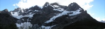
| | Panorama: Glacier del Frances
| | Day 5: The bridge crossing to Campo Italiano
| | Day 5: The bridge again
| (click to enlarge)
 | | (click to enlarge)
 | | (click to enlarge)
 | | Day 6: Lago Nordenskjold
| | Day 6: Lunch after the long shortcut
| | Day 7: The sad final shot of the Torres
|
|
| Wow, hm, I really have no idea how to go about writing this entry. Torres del Paine National Park is one of the best and most-visited trekking destinations in all of South America, if not the world. Along with Machu Picchu and Carnaval, it was one of the only things I actually had planned and was most excited for before I ever left for this trip. Our 7 days there were some of the best hiking I`ve ever done, though some of the most painful as well, and by far my longest backpacking trip ever. There are two main routes that trekkers to this national park take. One is called The W, which sees an overwhelmingly majority of the visitors, which is a 4-5 day one-way trek along the frontside of the mountains and up into the two main valleys (hence the W-shape of the route). The other is called The Circuit, which starts out walking along the backside of the range, comes up over a pass, and then continues on to do The W in reverse.
We set out to do The Circuit, but we were still on a somewhat tight schedule. Most books say The Circuit takes 8 days, with extra ones factored in for rest, poor weather, and additional day hikes up the valleys not always considered a part of the circuit. Well, we wanted to do all of this, but only had 8 days maximum. If we followed the route exactly and stopped when and where most hikers do we would have no room for error or days to stay still if the weather was really awful. And Torres is renowned for having very turbulent and unpredictable weather, especially since the trail can take you through many varying microclimates in a single day. One thing for sure, you are guaranteed to get rained on and experience severe winds at some point, you just hope this can be limited. Anyway, for all of these reasons, we decided to go at an accelerated pace and combine some days of the regular route to gain time and the possibility of taking an entire day of rest if the weather called for it. As a result, our days in Torres del Paine consisted of not much more than walking, eating, and sleeping, with maybe a bit of time for relaxation and hanging out depending on the day. The fact that we were down near the southern tip of the world during summer though, so sunset was not until 10:30pm, afforded us plenty of daylight to work with which helped tremendously. In 7 days, really 5 full days and two half-days, we walked over 130km or 80+ miles, with packs roughly weighing 30 pounds or so. Since most people opt only for The W, our first 3 days of hiking along the backside and over the pass saw much less company than our time on the frontside. The scenery is more barren and desolate, but offers another type of beauty and helps build suspense for the dramatic frontside. In fact, this whole route was based on the idea of suspense. You start slowly on the back with impressive and expansive views but nothing so spectacular. As you come over the pass you are immediately greeted with views of Glacier Grey which accompanies you over your next day or two of walking through forests, gorges, and cliff-hugging trails. And then you enter The W, and everything changes. Johno, who we met in Fitz Roy, described Torres as a Disneyland for nature lovers, and it is an apt description. The trails are full of people of all ages and from all walks of life, and in addition to camp sites there are fully equipped "Refugios" along the way to accomodate those who do not want to carry camping gear and food. While it does create more congestion, I am not opposed to this, as the natural wonder of this place should be made available to as many people as possible. Anyway, the suspense and drama of the trek is taken up a notch as you enter The W and spend a day walking up the Frances Valley to a lookout with 360-degree views. Then, the ultimate destination is the lookout at the base of the Torres themselves. Many people who cannot spend multiple days here still come to the park for a 19-km day hike up to this lookout and back. However, like Fitz Roy, it is more recommended to spend the night at one of the sites towards the end of the valley and then wake-up for a sunrise hike to this point. That was our grand plan, the master design. We would do our circuit, culminating in sunrise over the Torres, and then head back into town for a massive victory dinner. In fact, from about one hour into hiking on our first day we start discussing our victory dinner, and the fantasizing never stopped after that.
The trail itself was never so so difficult, it was just the overall impact of travelling great distances day after day that took its toll on our bodies. Still, we always trudged on, and always amazed people at our camp for the night when they asked where we had come from that morning. We kept a pretty good log of our route on one of the trail maps we had, so here is a general overview of our days. Different maps and books give different distances between the same markers, which is why we cannot be exact:
Day 1, 16km from the start to Camping Seron. We got off the bus and started walking at 1:00pm. Instead of catching a bus to the trailhead heding west and into The W, we chose to walk the road looking for a shortcut to a trail that goes north and onto the backside. We never found it, walked the 8 km or so the bus would have driven us, and started from the official trailhead. From there we continued on more or less in solitude to arrive at camp by 5:45.
Day 2, 28km to Campamento Los Perros. This was our biggest day, combining days 2 and 3 of the typical trek into one. We walked the majority of the backside this day, passing in and out of forests and beside lakes, on a constantly rising and falling yet pleasant path. Set off at 8:15am, and some time around 11am while passing Lago Paine I got separated from the group. I was in the back, and there were two ways to cross a stream when I arrived at one. Afterwards I wasn't sure which way the group had went, and ended up eventually stopping to let them catch up when in actuality they were ahead of me. We regrouped, and continued on to Camp Dickson, the final destination of the day for most people. We stopped for lunch on the mountainside before descending to the campsite, and had gret views of the site and Lago Dickson right beside it. By 3:30 we were back on our way, and entered a very forested stetch of trail that passes by a nice waterfall called Salto Los Perros. The remainder of the trail from here climbs up an exposed ridge for views of Glacier Perros from its base, and continues along the ridge to Campamento Perros. Though the distance was not so great, and the trail not so rough, this might have been the least enjoyable hiking of the trip. Already completely exhausted from the day, and quite sore from the all the work I had suddenly asked my body to do in the past 24 hours, we started to get drizzled on. A slight rain, albeit a bit chilly, would not have been such a problem, but it was accompanied by fierce unrelenting gusts of wind that steadily got stronger as we approached the ridge's crest. The force of the wind during some stretches of the Torres circuit is legendary and we had heard much talk of it in the days and weeks leading up to our trek. This was our first taste of it. As I climbed the final 50 meters up to the ridge a strong gust ripped the rain-cover right off of my pack and sent it soaring through the sky back behind us. I turned and watched it until it vanished in the distance, still high above the ground. I have no idea how far it ended up travelling but I figure it had to be at least a kilometer. All considered, it was actually a beautiful sight. I had no time to be pissed with the wind whipping rain droplets in my face, so we all pushed on and arrived with relief at the tree-protected grounds of Campamento Perros at 7:30pm. Luckily they had an enclosed shelter to cook inside. We made a huge hot meal, met a cool group of Chileans going in the same direction as us, and collapsed inside our sleeping bags.
Day 3, 18km over the pass to Campamento Los Guardas. We had to allow for a bit of a sleep-in, then got on the road at 10:15. We had heard it was possible to encounter mud up to your knees while walking through the woods on this first stretch of the day, and we did. While it was largely avoidable at times, and only up to your ankle at others, every now and then a simple step would find you more than half way up your shin in sticky glop. We enjoyed more than an hour of this, regrouped with Tanner at a river crossing after losing him in the trees, and proceeded on to the pass. Paso Gardner at 1241m is the highest point on The Circuit, and includes a 680m ascent immediately followed by a steeper 800m descent. And like most ridges in this park, the winds (or "gale-force westerlies") as you get closer to the summit gain in strength to reach enormous speeds. I had been using a walking stick up to this point as I find them incredibly helpful and employ them on every long hike I do. In a moment of irony, just as I was starting the rock-strewn pass (ascents and descents being the most handy time to have a walking aid), my stick got wedged between two rocks and as I moved foward it snapped in half. Hilarious. However, climbers of Paso Gardner in this direction are rewarded with a fantastic vista of 17km-long Glacier Grey stretching out before them just as they reach the summit, and this was an amazing sight to arrive to. We actually finished the pass faster than we had assumed, a testament to our increasing strength and conditioning, and took a quick somewhat wind-sheltered snack break among larger rocks high above Glacier Grey. We moved on, to the steep descent through more forest (where I found a new walking stick!), and got to Campamento Paso for a long lunch break at 3:15. Again, this is typically the stopping point for most travellers, but we had a long day ahead of us tomorrow, so we decided to push on. We crossed streams and gorges on cliffs paralleling Glacier Grey's side, to arrive at Campamento Los Guardas at 6:30. A nice meal and some relaxing later, it was time for bed.
Day 4, 23km to Campo Italiano. Campamento Los Guardas has easy access to an impressive lookout over Glacier Grey just minutes away, and so before leaving in the morning we all went out there for a quick look. It was a cloudy day with rain looming, but this actually produced a wonderful and large rainbow over one section of the glacier. We set out to walk for about 45 minutes when we would arrive at another lookout of the glacier, this time from head on. The nose or front of Glacier Grey is actually split in two by a large rock in the center of its ice wall, which appears to be the glacier's snout. From this new viewpoint we would be able to see both sides of the glacier. We got there, and there was a new and even more impressive rainbow, which is the second one in the photos. However it soon started drizzling on us, so we didn't stick around long. From there we walked along the edge of Lago Grey but high above its shores, and then up a small pass to a ridge. We took a break at the top, and once again the winds were ferocious. This may have been the strongest winds we experienced on the hike. I walked up to a very exposed rock and was actually able to lean foward to about a 45-degree angle without falling over since the wind kept me propped up. We continued on, and as an example of the many different microclimates all within this one park, in just a couple hours we were walking through a hot, warm, and lush valley on our way to the lunch spot. This is one of the most amazing things about Torres, the variety of climates and scenery that you can encounter from one moment to the next. We stoped at the Refugio on electric-blue Lago Pehoe for lunch, and we were officially now on The W. The site was packed, the amenities were elegant, and the toilets actually flushed. The scenery here was fabulous, with the gorgeous Lago Pehoe on one side and a large chunk of the Torres peaks visible on the other. It was hard to motivate to keep moving, we were once again quite sore and some of us had intense blisters, but the day's work was not done. We moved on, encountering significantly more people along the way now that we had turned a corner and entered the frontside, and got into Campo Italiano by 5:45. That night was probably the most social camp site we were at. We sat around our stove slowly cooking our soups and mashed potatoes meal, while sharing the stove with 2 Danish girls that didn't have equipment, and were also accompanied by Remi, a very cool French-Canadian guy who was camping next to us and was trekking alone so we invited him over. It was like a small little dinner party, everyone sharing food and stories, and it was really fun.
Day 5, 12km day hike up the Valley Frances and back. This was our easy day. Part of the motivation to our fast pace was to be able to do hike this picturesque valley without our large packs, and not have to move for the night afterwards so we could take it slowly. Also, if it happened to be rainy we would have waited a day without moving and tried again the next day. But one again, for the 5th straigth day, we were impossibly blessed with beautiful weather. So we gave ourselves a late sleep-in, a slow breakfast, and were on our way wieghtless by 12:30. The Valley Frances takes you up a rocky path past the hanging Glaciar del Frances, to a 360-degree panorama lookout of granite peaks, the one highest peak in the park at over 3,000m, and the glimmering Lago Pehoe far below through the valley in the distance. We brought sandwich fixens with us so made our lunch up here, and chilled for a while to soak in the sight as much as possible. It was just remarkable, and after 4 long days of hard walking this place was a great reward. On the way back down we stopped in front of the glacier again, and were treated to some enormous ice falls, one of which I got some pictures of. Due to the shear size of the glacier, and its many different tiers, a single ice fall could last minutes from the time it breaks off at the top, rumbles its way down over the different levels, and finally all comes to a stop at the bottom. Its an impressive and unforgettable sight. We got back to Campo Italiano in the mid-afternoon, and did nothing but rest and relax and recuperate until bedtime.
Day 6, 25 km to Campamento Torres. Our last really tough day of the trek, and we nailed it. By this point, we were hiking machines, and impressed even oursleves with our speed and the force with which we were now attacking any uphills we faced. We left camp at 8:45am to give ourselves plenty of time for rest along the way, knowing all along that "today is gonna suck". We cruised by Camping Los Cuernos and stopped for a long snack at nice rock lookout we found along the way. From there we continued on, and were actually able to take a slight shortcut at one point. See, by this time we had completed the whole loop of Torres and were approaching our starting point. Like I said earlier, many people come here just to do the day hike up to the Torres lookout and start from this point as well. But since we were approaching from the west we did not have to actually go all the way back to the starting point, and were able to cut through to meet back up with the lookout trail about a third of the way up it. However, this did mean we had to power up a constant, shadeless, sweaty, uphill for a bit over an hour to make this shortcut. By the time we rejoined the trail, we collapsed in the only shade we could find and chowed down on lunch. Only a tiny bit left! A long lunch break later, we moved on, then stopped again at Camping Chile for some cards and a Tang break and to wait out a brief rain passing through. It was only an hour after that to Campamento Torres, our home for the night, and start for our culminating sunrise hike the next day.
Day 7, 11km up and back to the bus. Well, this was the only disappointment of the trip, but it was a big one. We woke up at 4:30, but it was raining. We could still try to go for it since its an hour rock-hop to get to the lookout and maybe the weather would clear by then, but if not we were told it is completely pointless to go up there if it is cloudy since you won't see anything. This knowledge, the prospect of scrambling up slick boulders in the rain, and the fact that our bodies and sleeping bags were just begging to stay united made us opt out of the sunrise hike. We'll go up later. 7:30 came around and we decided to give it a shot. We met a group of Americans on their way down who had went up for sunrise and said they could not see a thing until well after sinrise when the clouds cleared for a few moments. Though still very cloudy, it was no longer raining. So we start the climb, but as we get up to the ridge it is still foggy and cloudy and we cannot see a thing. Then it starts to rain on us. We realize the weather isn't going anywhere soon, and now we had a tight schedule to get down and make our bus, so we headed back down to camp without ever even actually seeing the Torres. I have one sad photo where you can make out the base of these impressive towers and imagine what the rest would be like. We got back to camp, packed up our gear, and made the final joyous descent back down to our original starting point. We felt light as feathers, and were filled with pride and congratulations for one another as we strolled through the final steps of our voyage. Packs down, feet up, we played cards and sipped Mate whil waiting for the bus that would bring us back to Puerto Natales and civilization.
All in all, this was a fabulous and memorable experience. Sure, our goal and culminating moment of the entire trip was stolen from us by bad weather. The main reason for all our sweat and toil was never realized, and after spending 7 days in Torres National Park we never actually saw the Torres! However, pushing our bodies to work as hard as we did towards a common goal was reward in itself. There is a life lesson in there somewhere. You have a goal in mind, a reward, and the only way to get it is to push yourself to the limits and work as hard as you can imagine. You do it, you amaze yourself that you succeed, and then still don't get the reward. But that almost becomes secondary by that point, you suceeded. Plus, in this context, we still had an amazing six days of beautiful hiking and unprecedented good weather for Torres. In 7 full days we were only ever lightly drizzled on, only a few times, and each time for no more than 15 minutes! This is unheard of. It just happens that one of those times came at the most inopportune moments. Like I said, almost secondary. I take from this trip some great memories, delicious recipes for camp cooking, and the knowledge that when necessary I can be a pretty kickass trekker. Like seeing a fabulous movie over again or reading a great book twice, I can't wait to get back to this national park and do it all over again, jsut maybe a bit slower next time.
Once again I close with quotes from guidebooks describing Parque Nacional Torres del Paine
Lonely Planet:
"Torres del Paine is Chile`s most popular backpacker`s destination, and rightly so. A well-developed trail network accesses granite pillars, turqoise lakes, roaring rivers, creeping glaciers and dense forests to create a hiker`s paradise."
"Rising up from the flat steppes with breathtaking abruptness, the craggy mountains of Torres del Paine present an astonishing sight even when visited from far off on the park`s southeaster approach." (this is the sight in those first photos)
Footprints:
"Nothing prepares you for the spectacular beauty of Parque Nacional Torres del Paine... At its center is the glacer-topped granite massif Macizo Paine, from which rise the vertical pink granite Torres(towers)del Paine and, below them, the Cuernos (horns) del Paine, swooping buttresses of lighter granite under caps of darker sedimentary rock.From the vast Campo de Hielo Sur icecap pn its western edge, four main glaciers, Grey, Dickson, Zapata, and Tyndall, drop into vividly colored lakes formed by their meltwater: turqoise, ultramrine and pistachio expanses, some filled with wind-sculpted royal blue icebergs." |
| |
| |


